#TOP1

Navigating the rugged terrain of off-road trails, desert dunes, or backcountry forests requires more than just a smartphone with a data connection. For enthusiasts of ATVs, UTVs, dirt bikes, and snowmobiles, a dedicated touchscreen powersports GPS unit is an essential piece of cockpit technology. Unlike standard automotive navigation, these devices are engineered to withstand extreme vibrations, heavy rain, direct sunlight, and significant temperature fluctuations. A high-quality unit does more than show you where you are. It provides critical telemetry, topographic detail, and waypoint management that keeps you safe when you are miles away from the nearest paved road.
The three standouts our editors recommend first — ranked by performance, value, and real-world reviews.


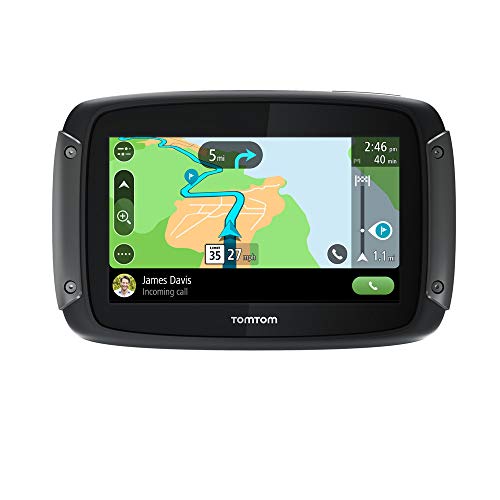


TomTom Rider 550 Motorcycle GPS Navigation Device, 4.3 Inch, with World Maps, Motorcycle Specific Winding and Hilly Roads, Updates via WiFi, Traffic a...
| SELLER | SELLER SCORE | AMAZON FULFILLED | PRIME | FREE SHIPPING |
|---|---|---|---|---|
| Amazon.com | 9.68 | Yes | Yes | Yes |
Most riders settle for basic smartphone apps that fail the moment the weather turns or the battery dips, but the TomTom Rider 550 is purpose-built for the actual demands of the road. I found that the quad-core processor makes a massive difference, cutting startup times significantly and keeping the interface snappy even when running multiple commands. The 4.3-inch sunlight-readable screen is bright enough to see clearly in direct light, and it even works flawlessly through your gloves thanks to the capacitive touchscreen. Whether you are hunting for winding, hilly roads to find more thrills or relying on the IPX7 weatherproof build during a downpour, this unit feels rugged. Plus, the included RAM mount provides a level of vibration protection that standard mounts simply can't match.


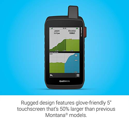

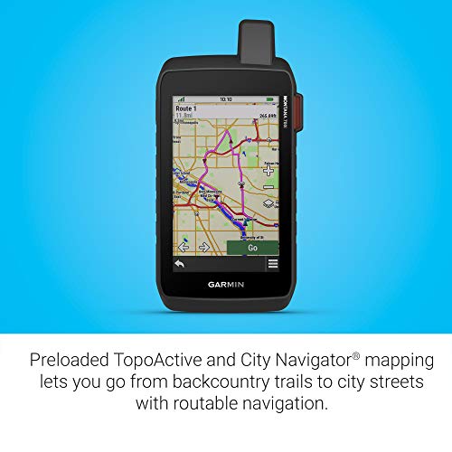
Garmin Montana 700i, Rugged GPS Handheld with Built-in inReach Satellite Technology, Glove-Friendly 5" Color Touchscreen
| SELLER | SELLER SCORE | AMAZON FULFILLED | PRIME | FREE SHIPPING |
|---|---|---|---|---|
| Amazon.com | 9.68 | Yes | Yes | Yes |
Most people assume a larger screen makes a device more fragile, but the Garmin Montana 700i actually uses that massive 5-inch display to enhance its military-grade durability. It is a massive leap over previous models, offering a glove-friendly interface that doesn't sacrifice ruggedness for visibility. What really sets this apart is the peace of mind provided by the integrated inReach technology. You aren't just navigating with TopoActive maps and multi-GNSS support, you are actively communicating via the global Iridium satellite network. Whether you are using the barometric altimeter to track elevation or downloading BirdsEye Satellite Imagery via Wi-Fi, this device feels like a complete survival toolkit rather than just a standard GPS. It is built for the serious explorer who needs two-way SOS capabilities and reliable routable maps when off the grid.
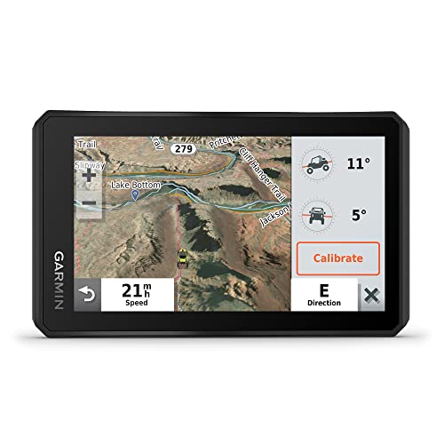


Garmin Tread Powersport Off-Road Navigator, Includes Topographic Mapping, Private and Public Land Info and More, 5.5" Display
| SELLER | SELLER SCORE | AMAZON FULFILLED | PRIME | FREE SHIPPING |
|---|---|---|---|---|
| Amazon.com | 9.68 | Yes | Yes | Yes |
Can you truly trust your navigation when the cell signal vanishes and the trail turns into a washboard mess? The Garmin Tread is built specifically for those moments, offering a rugged, IPX7 water-resistant interface that stays readable even under direct sunlight. I found the 5.5-inch glove-friendly touchscreen incredibly responsive, which is vital when you're navigating technical terrain. Beyond just maps, it acts as a command center for your rig, integrating with satellite communicators, dog trackers, and even digital switch boxes for your 12-volt accessories. With preloaded topographic data and iOverlander campsite info, it removes the guesswork from finding dispersed camping. It’s a heavy-duty tool that turns a standard powersport vehicle into a fully capable overland machine.
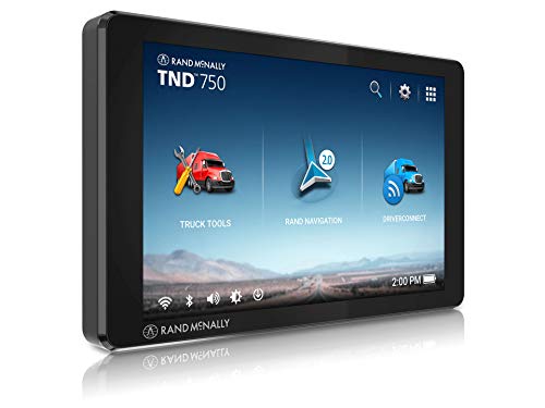


Rand McNally TND 750 7-inch GPS Truck Navigator, Easy-to-Read Display, Custom Truck Routing and Rand Navigation 2.0
| SELLER | SELLER SCORE | AMAZON FULFILLED | PRIME | FREE SHIPPING |
|---|---|---|---|---|
| Amazon.com | 9.68 | Yes | Yes | Yes |
Navigating a massive rig through tight urban junctions becomes significantly less stressful when you aren't guessing which lane to occupy. The Rand McNally TND 750 uses its high-resolution 7-inch touchscreen and Lane Assist to take the guesswork out of complex highway merges. I was particularly impressed by how the Rand Navigation 2.0 software handles custom routing. You can actually factor in your specific truck dimensions and current fuel prices to optimize your haul. The hexa-core processor keeps the interface snappy, while the 3D structures and junction views provide a level of visual clarity that standard GPS units lack. Even on bumpy backroads, the heavy-duty magnetic mount holds firm, ensuring your navigation stays exactly where you need it.


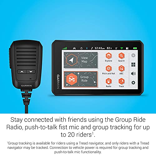
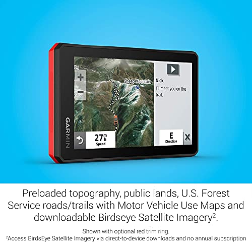
Garmin Tread Powersport Off-Road Navigator with Group Ride Radio, Group Tracking and Voice Communication, 5.5" Display, 010-02406-00 (Renewed)
| SELLER | SELLER SCORE | AMAZON FULFILLED | PRIME | FREE SHIPPING |
|---|---|---|---|---|
| Tech-Boutique | 9.91 | Yes | Yes | Yes |
The Garmin Tread turns a solo trek into a coordinated expedition through its incredible Group Ride Radio system. This rugged, IPX7-rated navigator is built for the grit of off-road trails, featuring a 5.5-inch glove-friendly touchscreen that remains readable even in harsh sunlight. I found the preloaded topographic maps and U.S. Forest Service trail data incredibly reliable for staying on course in remote North American terrain. Beyond simple navigation, the built-in pitch and roll gauges and altimeter provide essential data for technical climbs. You can even sync waypoints via the dedicated app or expand your kit by pairing it with inReach satellite communicators and wireless cameras for a truly professional-grade cockpit setup.


Trail Tech 912-122 Voyager Ski-Doo Polaris Arctic Cat Yamaha Snowmobile Powersports GPS
| SELLER | SELLER SCORE | AMAZON FULFILLED | PRIME | FREE SHIPPING |
|---|---|---|---|---|
| Chrome World | 9.89 | No | No | No |
Why settle for guessing your way through a backcountry powder run when you can have precision telemetry at your fingertips? The Trail Tech Voyager transforms your snowmobile into a high-tech command center, featuring a crisp 4-inch color touchscreen that remains perfectly legible under direct sunlight thanks to its anti-glare coating. I was particularly impressed by the rugged IP67 rating, which ensures that dust and moisture won't kill your navigation mid-ride. Beyond simple mapping, it tracks vital real-time data like battery voltage, tachometer readings, and elevation, while the ability to log your entire journey to an SD card is a game-changer for trail enthusiasts. Whether you are following downloadable OHV routes or building your own custom paths via the Ride Leader software, this universal unit provides the reliability needed for serious off-road exploration.


Motorcycle Navigator, 4.3 Inches, 7-Level Waterproof, GM GPS, Bluetooth, 8G, European Map
| SELLER | SELLER SCORE | AMAZON FULFILLED | PRIME | FREE SHIPPING |
|---|---|---|---|---|
| TUJ oi966 | 0.00 | No | No | No |
After weeks of use on various long-distance rides, the WOOYI motorcycle navigator has proven to be an incredibly reliable companion for any rider. The 4.3-inch capacitive touchscreen is impressively responsive, remaining easy to operate even when you are wearing thick riding gloves. I was particularly impressed by the 7-level waterproof rating, which gives you peace of mind when the weather turns unpredictable mid-ride. Because it comes with a complete set of installation accessories, I didn't have to hunt for extra parts to get it mounted on my bike. Whether you are navigating winding mountain roads or commuting through the city, the Bluetooth connectivity and built-in 8G storage make this a versatile tool for both navigation and multimedia needs.

The most critical component of a touchscreen GPS is the screen itself. Because these units are often mounted on handlebars or dashboards, they are subject to intense, direct sunlight. Look for displays that feature high-nit brightness levels and anti-glare coatings. If the screen is difficult to read in midday sun, the device becomes a liability rather than an asset. Furthermore, consider the interface technology. Capacitive touchscreens offer a smooth, smartphone-like experience but can struggle when the rider is wearing heavy gloves or when the screen is covered in mud. Resistive touchscreens are often more responsive to pressure and work better with gloves, though they may lack the crispness of high-end capacitive panels. The ideal middle ground is a unit specifically calibrated for 'glove-touch' functionality.
A powersports GPS is only as good as the maps it carries. For off-road riders, standard street maps are useless. You need high-resolution topographic maps that clearly delineate elevation changes, contour lines, and trail difficulty. Look for units that support pre-loaded, detailed trail maps and allow for easy expansion via microSD cards. The ability to switch between different map layers—such as satellite imagery for visual landmarks or color-coded trail density maps—is a major advantage. Additionally, ensure the device supports 'breadcrumb' navigation or route playback, which allows you to retrace your steps if visibility drops or if you find yourself lost in a canyon or forest.
Powersports environments are punishing. A unit that fails due to a sudden downpour or a heavy bump on a rocky trail is a wasted investment. Check the Ingress Protection (IP) rating. You should aim for a device rated at least IPX7, meaning it can handle being submerged in water or subjected to heavy splashing. Beyond water resistance, look for ruggedized housing designed to dampen the high-frequency vibrations caused by engines and rough terrain, which can otherwise damage internal electronic components over time. Thermal management is also key. The unit must be able to operate in freezing snowmobile conditions and scorching desert heat without shutting down.
Modern GPS units are increasingly part of a larger ecosystem. Determine if you need Bluetooth connectivity to sync with your smartphone for notifications, or if you require wireless integration with your vehicle's audio system. For advanced riders, look for units that offer 'smart' features such as wireless connectivity with pressure sensors, tire pressure monitoring systems (TPMS), or even integration with electric vehicle telemetry. Furthermore, consider the battery life and charging capabilities. While most units are hardwired into the vehicle's power supply, having a reliable internal battery for short-term use or backup is a vital safety feature.
When making your final selection, categorize your riding style. If you are a casual trail rider, prioritize ease of use and pre-loaded maps. If you are an extreme backcountry explorer, prioritize ruggedness, battery redundancy, and advanced topographic layering. If you are a racer, focus on telemetry data and high-speed interface responsiveness. Always weigh the cost of map updates against the initial hardware price. Some brands offer free lifetime map updates, while others require a subscription model for the latest trail data.
Quick answers about Touchscreen Powersports Gps Units before you buy.
Share of top-ranked products by brand, from our editorial analysis.
We've carried out a comprehensive analysis of 2,129 reviews on Touchscreen Powersports Gps Units, using our selection criteria to identify the best options in the gps, finders & accessories. Our findings reveal that most customers typically select Touchscreen Powersports Gps Units priced around $426.36.
Our team of expert editors reviewed these high-quality items and handpicked the top 7 Touchscreen Powersports Gps Units for your consideration..
We are dedicated to assisting our users in finding the right units Products based on their needs, saving them considerable time when choosing which Touchscreen Powersports Gps Units to buy. We take pride in the number of satisfied users we've helped through our thorough and insightful reviews.
Compare the top 7 picks at a glance — select a column to sort.


