#TOP1
Navigating open waters requires more than just a compass and a sense of direction. It demands high-fidelity situational awareness provided by a reliable GPS chartplotter. Whether you are a weekend coastal cruiser or a long-distance offshore fisherman, the ability to overlay real-time positioning data onto high-resolution nautical charts is the backbone of maritime safety. A modern chartplotter does more than show you where you are. It integrates sonar data, weather overlays, and waypoint management to turn raw data into actionable intelligence. This guide is designed to help you navigate the complex technical landscape of marine electronics so you can select a device that matches your vessel's specific needs and your personal navigation style.
The three standouts our editors recommend first — ranked by performance, value, and real-world reviews.

Garmin Striker Plus 4 with Dual-Beam transducer, 010-01870-00
| SELLER | SELLER SCORE | AMAZON FULFILLED | PRIME | FREE SHIPPING |
|---|---|---|---|---|
| Amazon.com | 9.68 | Yes | Yes | Yes |
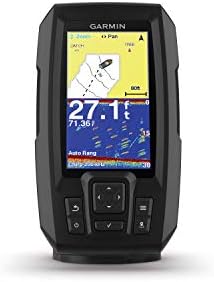
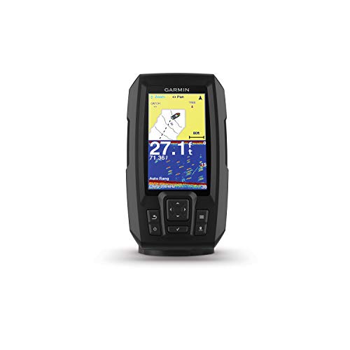
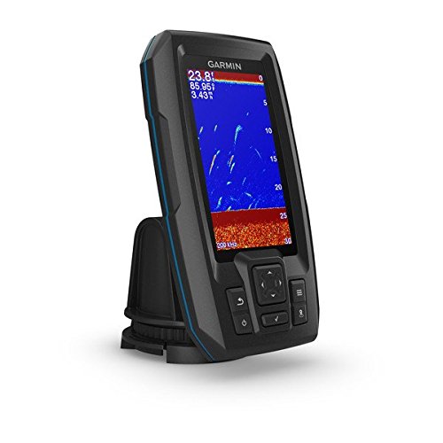
Can a compact fishfinder actually provide the level of detail usually reserved for much larger, more expensive units? The Garmin Striker Plus 4 proves it can by utilizing Garmin Chirp traditional sonar to deliver remarkably clear images and superior target separation. While the 4.3-inch display is sunlight-readable and easy to navigate via touch, the real magic lies in the mapping capabilities. You can use the built-in Quickdraw Contours software to create your own 1-foot contour maps for up to 2 million acres, giving you a massive advantage on the water. It is a rugged, reliable tool that integrates GPS for waypoint marking and speed tracking, making it a powerhouse for anglers who need precision without the bulk.




Garmin ECHOMAP UHD 74Cv, 7" Keyed-Assist Touchscreen Chartplotter with U.S. BlueChart G3 and GT24UHD-TM Transducer
| SELLER | SELLER SCORE | AMAZON FULFILLED | PRIME | FREE SHIPPING |
|---|---|---|---|---|
| Prime Marine | 9.71 | No | No | No |
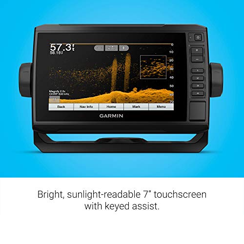
Most anglers settle for grainy sonar images and outdated maps, but the Garmin ECHOMAP UHD 74cv elevates your time on the water with high-definition clarity. Testing this unit revealed how much the included GT24 transducer matters. The ultra High-Definition scanning provides a crisp view of what is happening beneath your boat. The 7-inch touchscreen is impressively bright and remains easy to read even under direct sunlight, though the keyed-assist feature is the real hero when your hands are wet or you need tactile reliability. Having preloaded BlueChart G3 coastal charts means you can navigate with confidence immediately. Plus, the ability to share sonar data with other ECHOMAP units makes it a seamless addition to a multi-boat setup.



Lowrance HOOK Reveal 5 Inch Fish Finders with Transducer, Plus Optional Preloaded Maps
| SELLER | SELLER SCORE | AMAZON FULFILLED | PRIME | FREE SHIPPING |
|---|---|---|---|---|
| USCollectibles | 0.00 | No | No | No |
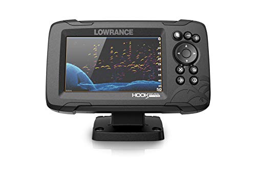
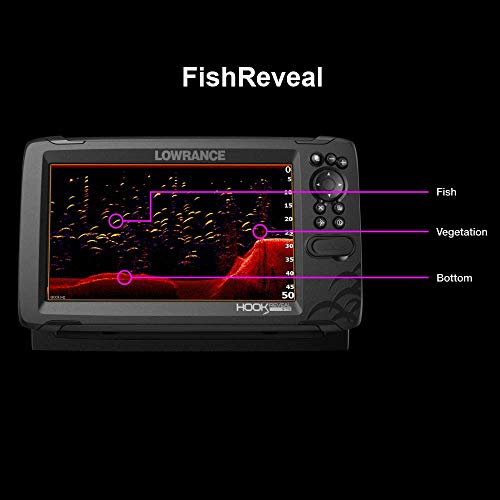
Small-craft anglers who refuse to compromise on sonar clarity need the Lowrance HOOK Reveal in their arsenal immediately. This compact unit punches way above its weight class by utilizing FishReveal technology, which essentially makes fish pop against the background by merging CHIRP sonar with DownScan Imaging. I found the SolarMAX display particularly impressive because it remains perfectly legible even when the sun is beating down directly on the water. You won't have to waste your morning fiddling with menus either. The autotuning sonar handles the technical adjustments for you as conditions shift. Combined with the SplitShot transducer for detailed structure views and a reliable GPS plotter for hitting your favorite waypoints, this setup turns a basic outing into a precision mission.



Garmin GPSMAP 66s, Rugged Multisatellite Handheld with Sensors, 3" Color Display
| SELLER | SELLER SCORE | AMAZON FULFILLED | PRIME | FREE SHIPPING |
|---|---|---|---|---|
| Amazon.com | 9.68 | Yes | Yes | Yes |
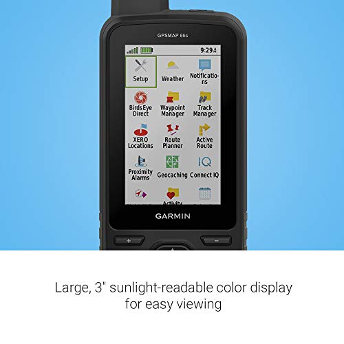
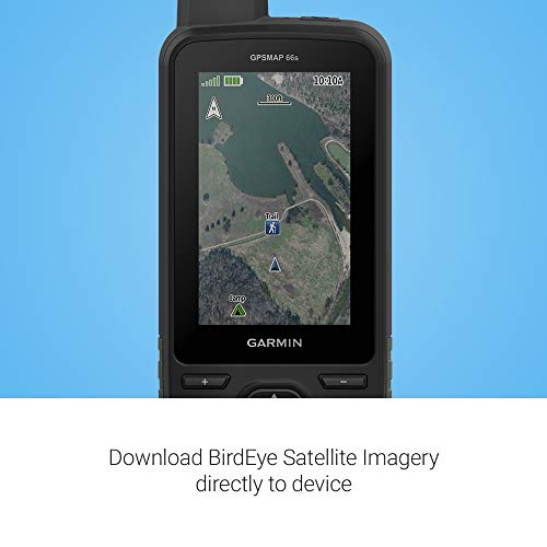
The sunlight-readable 3-inch color display hits your eyes with immediate clarity, even when you are standing under a harsh midday sun on an open ridge. This isn't just a basic tracker. The GPSMAP 66s is a serious tool for anyone navigating challenging environments where standard GPS might fail. By utilizing multiple Global Navigation Satellite Systems alongside a built-in three-axis compass and barometric altimeter, it provides a level of precision that feels incredibly reliable. I particularly like how the BirdsEye Satellite Imagery works with direct-to-device downloads, meaning you get high-detail visuals without worrying about an annual subscription. Between the preloaded TOPO maps for North America and the ability to sync animated weather radar via expanded wireless connectivity, you feel much more prepared for the unpredictability of the backcountry.


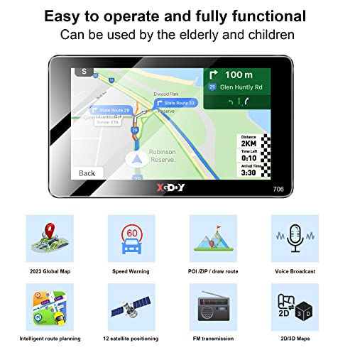

XGODY GPS Navigation for car 2.5D Screen 7 inch 2023 maps car GPS for car Truck GPS Commercial Drivers semi Trucker Navigation System 8GB 256M with Vo...
| SELLER | SELLER SCORE | AMAZON FULFILLED | PRIME | FREE SHIPPING |
|---|---|---|---|---|
| You Like US | 9.64 | Yes | Yes | Yes |
After weeks of use on long-haul routes, the XGODY 7-inch navigation system has proven to be a reliable co-pilot for professional drivers. The standout feature is definitely the 2.5D curved screen, which offers a much wider viewing angle and better light transmission than standard flat displays, making it easy to read even under direct sunlight. It is specifically tailored for commercial needs, allowing you to customize routes based on vehicle type to avoid dangerous height or weight restrictions. Whether you are driving a semi-truck, a bus, or a standard car, the intelligent system provides helpful speed warnings and identifies nearby gas stations and rest areas. With lifetime map updates included, this unit feels like a long-term investment for anyone navigating North America.


| SELLER | SELLER SCORE | AMAZON FULFILLED | PRIME | FREE SHIPPING |
|---|---|---|---|---|
| tian mei | 7.14 | Yes | Yes | Yes |
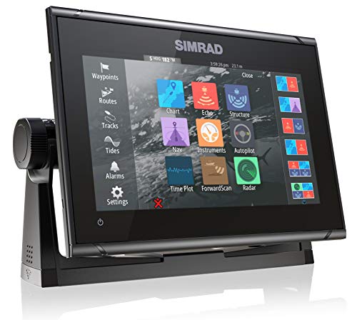


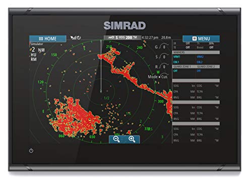

Simrad GO9 XSE - 9-inch Chartplotter with Active Imaging 3-in-1 Transducer, C-MAP Discover Chart Card
| SELLER | SELLER SCORE | AMAZON FULFILLED | PRIME | FREE SHIPPING |
|---|---|---|---|---|
| Amazon.com | 9.68 | Yes | Yes | Yes |
Most boaters settle for basic GPS units that leave them blind to what is happening beneath the hull, but the Simrad GO9 XSE changes the game by integrating high-definition sonar and navigation into one compact interface. During testing, the Active Imaging 3-in-1 transducer stood out, delivering incredibly refined detail through CHIRP, SideScan, and DownScan technology. The FishReveal feature makes spotting targets through cover much more intuitive than standard sonar. It is a versatile powerhouse for center-consoles or smaller cruisers, especially since it comes ready for radar integration and includes a comprehensive C-MAP Discover card for detailed bathymetric contours. Being able to mirror your display to a smartphone means you aren't tethered to the helm, providing a level of connectivity that makes navigating US and Canadian waters feel seamless.

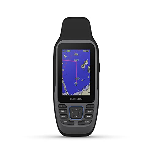
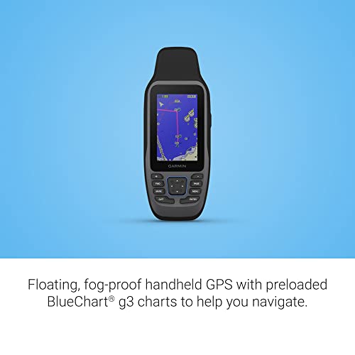
Garmin GPSMAP 79sc, Marine GPS Handheld Preloaded With BlueChart g3 Coastal Charts, Rugged Design and Floats in Water
| SELLER | SELLER SCORE | AMAZON FULFILLED | PRIME | FREE SHIPPING |
|---|---|---|---|---|
| Amazon.com | 9.68 | Yes | Yes | Yes |
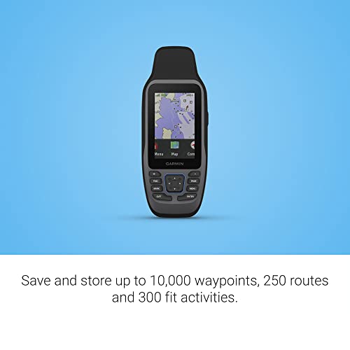
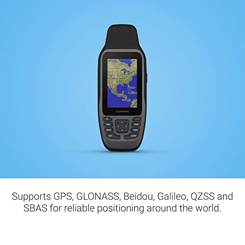
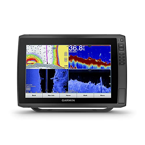
The Garmin GPSMAP 79sc is a lifesaver for mariners because it actually floats when it hits the water. I found the rugged, IPX6 water-resistant build incredibly reassuring during choppy coastal excursions, especially with that scratch-resistant, fogproof glass protecting the high-resolution display. It comes preloaded with BlueChart g3 coastal charts, which takes the guesswork out of navigation immediately. The tracking is impressively reliable thanks to support for multiple satellite constellations like GLONASS and Galileo, ensuring you aren't lost even in tricky environments. With a built-in 3-axis tilt-compensated electronic compass and a barometric altimeter for altitude tracking, this unit feels like a complete toolkit. Plus, the increased memory allows you to log a massive amount of waypoints and activities without running out of space.


| SELLER | SELLER SCORE | AMAZON FULFILLED | PRIME | FREE SHIPPING |
|---|---|---|---|---|
| OpticsPlanet, Inc | 9.64 | No | No | No |




Simrad NSX 3007 - Chartplotter Fish Finder with Active Imaging 3-in-1 Transducer and C-MAP Discover X Charts, Black
| SELLER | SELLER SCORE | AMAZON FULFILLED | PRIME | FREE SHIPPING |
|---|---|---|---|---|
| Amazon.com | 9.68 | Yes | Yes | Yes |
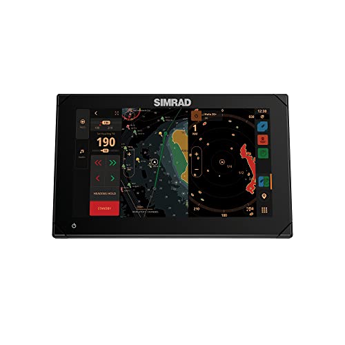
The Simrad NSX 3007 delivers professional-grade sonar clarity through its impressive Active Imaging capabilities. While testing this 7-inch unit, the high-definition IPS touchscreen stood out immediately, remaining perfectly legible even when I was wearing polarized sunglasses on the water. You get a massive amount of data visualization here, from SideScan to DownScan, all supported by the intuitive C-MAP Discover X charts that keep your navigation feeling fresh. It is not just a standalone tool. The ability to integrate with autopilot, radar, and additional sonar makes it a foundational piece for a serious vessel. Even if you are new to marine electronics, the built-in setup wizard takes the guesswork out of configuring your transducer settings so you can focus on finding fish.



Simrad GO7 XSR - 7-inch Chartplotter with HDI Transducer, C-MAP Discover Chart Card
| SELLER | SELLER SCORE | AMAZON FULFILLED | PRIME | FREE SHIPPING |
|---|---|---|---|---|
| Amazon.com | 9.68 | Yes | Yes | Yes |
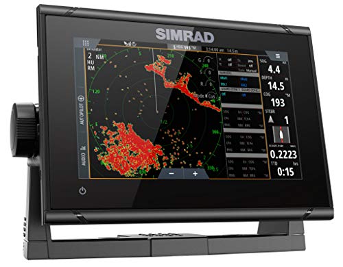
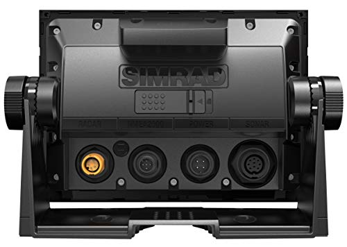
Most boaters assume a compact 7-inch screen limits your situational awareness, but the Simrad GO7 XSR proves that intelligence matters more than sheer surface area. This unit punches well above its weight class, acting as a command center for center-consoles and smaller cruisers through seamless NMEA 2000 integration. The included HDI transducer is a standout, utilizing Medium and High CHIRP technology alongside DownScan Imaging to turn murky depths into clear, picture-like views of underwater structures. You aren't just getting a GPS. The inclusion of a C-MAP Discover card with high-resolution bathymetric contours means you're navigating with professional-grade data right out of the box. Plus, the ability to mirror your display to a tablet keeps your charts accessible even when you're away from the helm.

| SELLER | SELLER SCORE | AMAZON FULFILLED | PRIME | FREE SHIPPING |
|---|---|---|---|---|
| Lifeline Brands | 9.85 | No | No | No |

In a marine environment, your screen is your most critical interface. Unlike indoor electronics, a chartplotter must remain legible under direct, high-intensity sunlight and through the glare of salt spray. When evaluating devices, prioritize high-nit brightness levels and anti-reflective coatings. A high-resolution display is not just about aesthetics. Higher pixel density allows for much finer detail on dense nautical charts, making it easier to distinguish between shallow sandbars, buoy markers, and depth contours. Opt for capacitive touchscreens if you prefer a smartphone-like experience, but ensure they are rated for use with gloves or when wet, as capacitive technology can sometimes struggle with water droplets on the surface.
The 'intelligence' of your chartplotter is entirely dependent on the quality of the maps it runs. Look for devices that support industry-standard nautical databases. High-quality charts provide essential information such as water depths, bottom composition, navigational hazards, and aids to navigation. Consider whether you need pre-loaded charts or if the device allows for easy expansion via SD cards. For those who frequently change regions, the ability to swap out regional map cards is a significant advantage. Furthermore, check if the device supports layered mapping, which allows you to toggle between topographic views, bathymetric data, and satellite imagery to get a better sense of your surroundings.
A chartplotter rarely operates in isolation. It serves as the central hub for your vessel's electronic ecosystem. You must consider how the unit integrates with your existing or planned hardware. Does it support NMEA 2000 networking? This is the gold standard for marine electronics, allowing the chartplotter to communicate with your engine data, fuel sensors, wind transducers, and autopilot. Additionally, if you are an angler, look for seamless integration with sonar/fishfinder modules. The ability to view a live sonar feed on the same screen as your GPS map is a game-changer for finding structure and tracking fish in real-time.
Marine electronics face a brutal trifecta of salt, UV exposure, and constant vibration. A professional-grade chartplotter should have a high IP (Ingress Protection) rating to ensure that moisture and dust cannot penetrate the internal circuitry. Beyond waterproofing, look for ruggedized housing materials that resist corrosion. The mounting options are also vital. Ensure the device includes a secure, vibration-resistant bracket that can handle the movement of a boat in choppy seas. A device that is easy to install and has a streamlined wiring harness will save you significant time and frustration during the setup process.
Quick answers about Photo Viewer Gps Chartplotters before you buy.
Share of top-ranked products by brand, from our editorial analysis.
We've carried out a comprehensive analysis of 2,858 reviews on Photo Viewer Gps Chartplotters, using our selection criteria to identify the best options in the categories. Our findings reveal that most customers typically select Photo Viewer Gps Chartplotters priced around $547.06.
Our team of expert editors reviewed these high-quality items and handpicked the top 12 Photo Viewer Gps Chartplotters for your consideration..
We are dedicated to assisting our users in finding the right finders Products based on their needs, saving them considerable time when choosing which Photo Viewer Gps Chartplotters to buy. We take pride in the number of satisfied users we've helped through our thorough and insightful reviews.
Compare the top 12 picks at a glance — select a column to sort.


