#TOP1
For serious hikers, backpackers, and backcountry explorers, relying solely on a smartphone for navigation is a gamble. Between battery depletion, signal loss in deep canyons, and the fragility of glass screens, a dedicated handheld GPS unit is an essential piece of safety equipment. Unlike mobile apps, these rugged devices are purpose-built to thrive in extreme temperatures, resist water ingress, and maintain a lock on multiple satellite constellations even under heavy canopy. Choosing the right unit requires balancing the need for precise mapping against the necessity of long-term battery reliability and ease of use in high-stress situations.
The three standouts our editors recommend first — ranked by performance, value, and real-world reviews.



Garmin eTrex 22x, Rugged Handheld GPS Navigator, Black/Navy
| SELLER | SELLER SCORE | AMAZON FULFILLED | PRIME | FREE SHIPPING |
|---|---|---|---|---|
| Amazon.com | 9.68 | Yes | Yes | Yes |
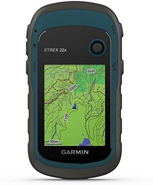
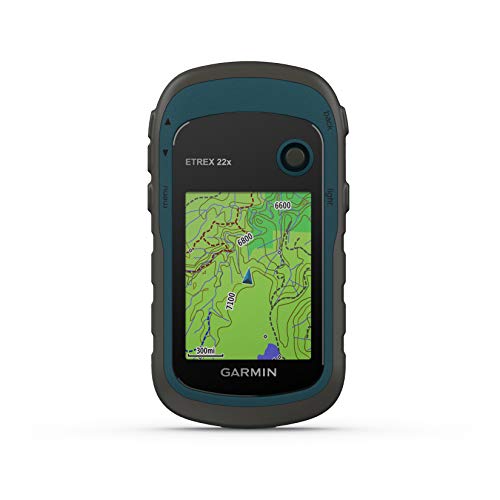
The Garmin eTrex 22x stands as a reliable cornerstone for outdoor enthusiasts who need dependable navigation without the fragility of a smartphone. This rugged handheld device excels in the field thanks to its dual GPS and GLONASS satellite support, which ensures you stay on track even when the canopy gets thick or the terrain gets tough. The 2.2-inch color display remains surprisingly readable under direct sunlight, making it easy to follow the preloaded Topo Active maps through winding trails or cycling routes. With 8 GB of internal memory and an expandable micro SD slot, you have plenty of room for extra topographical data. Plus, running on two AA batteries provides a solid 25 hours of tracking, so you won't be left searching for a power outlet in the middle of the woods.


Garmin eTrex 10 Worldwide Handheld GPS Navigator
| SELLER | SELLER SCORE | AMAZON FULFILLED | PRIME | FREE SHIPPING |
|---|---|---|---|---|
| Amazon.com | 9.68 | Yes | Yes | Yes |
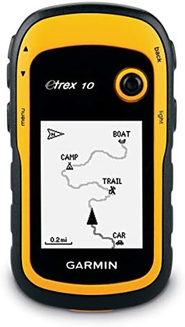
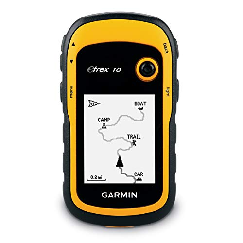
Deep in a dense forest canopy where cell signals go to die, the Garmin eTrex 10 becomes your most reliable companion. This rugged little navigator is built for the grit of real-world exploration, featuring a 2.2 inch monochrome display that remains readable even when things get messy. I found the dual support for GLONASS and WAAS incredibly helpful for maintaining a fast, reliable signal in tricky terrain. It handles splashes and heavy rain with ease thanks to its IPX7 waterproof rating, making it a perfect tool for paperless geocaching. You can even track high and low elevation points to better estimate your trek's distance and time. Running on two AA batteries for up to 20 hours, it’s a dependable, low-maintenance piece of gear for any serious hiker.
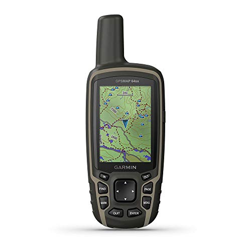
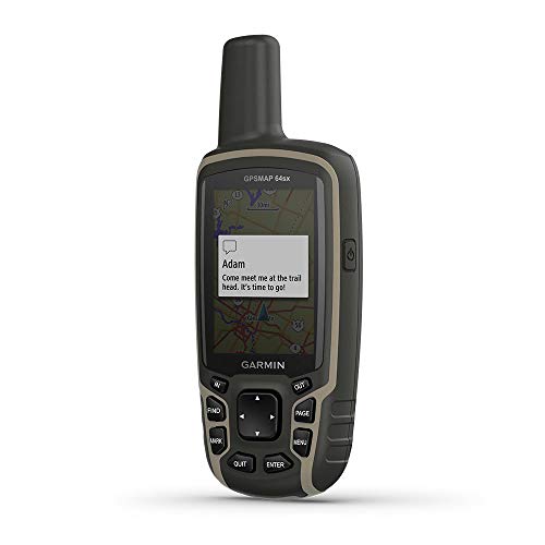


Garmin GPSMAP 64sx, Handheld GPS with Altimeter and Compass, Preloaded With TopoActive Maps, Black/Tan
| SELLER | SELLER SCORE | AMAZON FULFILLED | PRIME | FREE SHIPPING |
|---|---|---|---|---|
| GPS City | 9.86 | Yes | Yes | Yes |
After weeks of use in unpredictable backcountry conditions, the Garmin GPSMAP 64sx has proven to be an indispensable tool for serious navigation. The rugged, water-resistant chassis feels incredibly durable, and the button-operated interface is a lifesaver when your hands are cold or wet. I was particularly impressed by the quad helix antenna. It maintains a high-sensitivity connection using GPS, GLONASS, and Galileo even under heavy tree canopy. The 2.6-inch color display remains perfectly sunlight-readable during midday treks, while the preloaded TopoActive maps make finding routable trails for hiking or cycling seamless. With a barometric altimeter and 3-axis compass, you get a complete picture of your environment, backed by a solid 16-hour battery life that lasts through a full day of exploration.


Spot Gen 4 Satellite GPS Messenger | Handheld Portable GPS Messenger for Hiking, Camping, Outdoor Activities | Globalstar Satellite Network Coverage |...
| SELLER | SELLER SCORE | AMAZON FULFILLED | PRIME | FREE SHIPPING |
|---|---|---|---|---|
| SPOT LLC. | 5.33 | Yes | Yes | Yes |
The SPOT X Gen 4 acts as a literal lifeline when your adventures take you far beyond the reach of cellular towers. I found that the ability to transmit precise GPS coordinates via the Globalstar Satellite Network provides a massive sense of security for backcountry hikers and campers. Whether you are checking in with family to say you are safe or hitting the SOS button to alert emergency responders, this handheld device bridges the communication gap in the wild. The tracking feature is particularly clever, allowing for location updates both while you are moving and when you pause. It is a rugged, essential piece of kit for anyone who refuses to let a lack of signal limit their exploration.
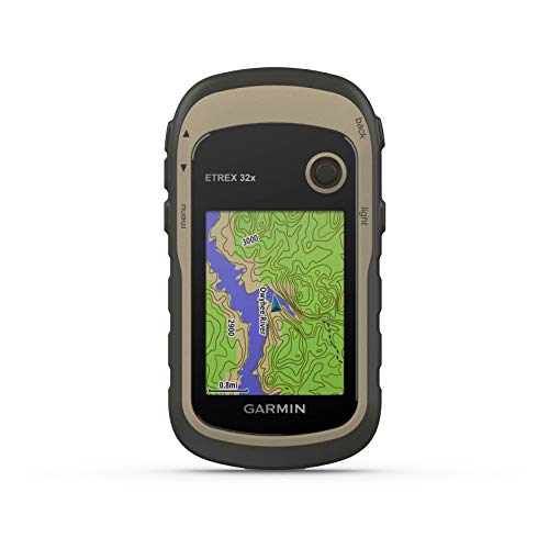


Garmin eTrex 32x, Rugged Handheld GPS Navigator
| SELLER | SELLER SCORE | AMAZON FULFILLED | PRIME | FREE SHIPPING |
|---|---|---|---|---|
| Amazon.com | 9.68 | Yes | Yes | Yes |
The Garmin eTrex 32x stands as a dependable cornerstone in the handheld GPS category, offering a rugged build that won't quit when the terrain gets tough. I found the 2.2-inch sunlight-readable color display to be a massive help when navigating bright trails, and the preloaded Topo Active maps make finding routable roads and hiking paths feel intuitive right out of the box. What really sets this version apart is the inclusion of a 3-axis compass and barometric altimeter, which provide much-needed precision in deep canyons or dense woods. Because it tracks both GPS and GLONASS satellite systems, you get much better reliability in challenging environments. With 8 GB of internal memory and a micro SD slot, you have plenty of room to expand your digital library for long-distance expeditions.


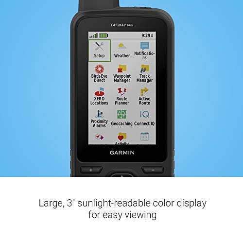

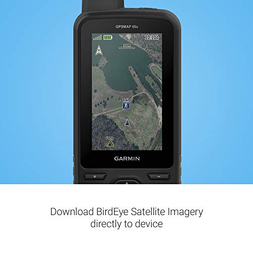
Garmin GPSMAP 66s, Rugged Multisatellite Handheld with Sensors, 3" Color Display
| SELLER | SELLER SCORE | AMAZON FULFILLED | PRIME | FREE SHIPPING |
|---|---|---|---|---|
| Amazon.com | 9.68 | Yes | Yes | Yes |
The sunlight-readable 3-inch color display hits your eyes with immediate clarity, even when you are standing under a harsh midday sun on an open ridge. This isn't just a basic tracker. The GPSMAP 66s is a serious tool for anyone navigating challenging environments where standard GPS might fail. By utilizing multiple Global Navigation Satellite Systems alongside a built-in three-axis compass and barometric altimeter, it provides a level of precision that feels incredibly reliable. I particularly like how the BirdsEye Satellite Imagery works with direct-to-device downloads, meaning you get high-detail visuals without worrying about an annual subscription. Between the preloaded TOPO maps for North America and the ability to sync animated weather radar via expanded wireless connectivity, you feel much more prepared for the unpredictability of the backcountry.


Garmin Montana 680, Touchscreen Hiking Handheld, GPS/GLONASS with 8 Megapixel Camera
| SELLER | SELLER SCORE | AMAZON FULFILLED | PRIME | FREE SHIPPING |
|---|---|---|---|---|
| Top Sports | 9.93 | Yes | Yes | Yes |
Backcountry explorers who demand precision in the most unforgiving terrain will find the Garmin Montana 680 to be an indispensable survival tool. I was particularly impressed by how the combination of GPS and GLONASS keeps your position locked in, even when you are navigating through dense forest cover or deep, narrow canyons. The high-sensitivity receiver and Hotfix satellite prediction mean you aren't left guessing where you are when the weather turns. Beyond simple navigation, the built-in 8 megapixel camera is a massive plus for documenting your journey, as every photo is automatically geotagged with your exact coordinates. Managing your trek is seamless thanks to the Track Manager, which lets you organize waypoints and routes while easily toggling track log recording on or off during your hike.
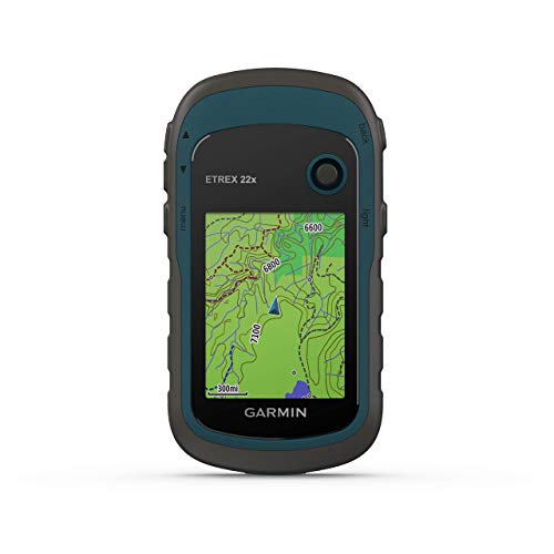


Garmin eTrex 22x, Rugged Handheld GPS Navigator (Renewed)
| SELLER | SELLER SCORE | AMAZON FULFILLED | PRIME | FREE SHIPPING |
|---|---|---|---|---|
| No | No | No |
The sunlight-readable color display on this Garmin unit immediately cuts through the glare of a midday trek, making it easy to read even in the harshest conditions. I found that having Topo Active maps preloaded takes much of the guesswork out of navigating complex trails or cycling routes. Because it tracks both GPS and GLONASS satellite systems, you get a level of reliability in deep canyons or heavy tree cover that standard devices often struggle with. The 8 GB of internal memory gives you plenty of room for essential data, but the micro SD card slot is the real winner for anyone looking to expand their mapping library. It is a rugged, dependable companion that feels built for the actual elements rather than just a casual walk.


Garmin Montana 700 Rugged GPS Touchscreen Navigator with Included Wearable4U Ultimate E-Bank Bundle
| SELLER | SELLER SCORE | AMAZON FULFILLED | PRIME | FREE SHIPPING |
|---|---|---|---|---|
| Sports-and-Gadgets | 9.89 | Yes | Yes | Yes |
The Garmin Montana 700 stands as the definitive navigation powerhouse for serious backcountry explorers who demand reliability in extreme environments. I found the 5-inch glove-friendly touchscreen to be a massive upgrade, providing much better visibility during rugged treks than its predecessors. Because it is built to MIL-STD 810 standards, it handles thermal, shock, and water stress without breaking a sweat. The inclusion of multi-GNSS support ensures you stay on course using GPS, GLONASS, and Galileo, while the preloaded TopoActive maps make orientation intuitive. What really sets this Wearable4U bundle apart is the 2200 mAh E-bank charger, which effectively eliminates battery anxiety during long-distance expeditions. Between the ANT+ connectivity and the robust sensor suite, this is a complete toolkit for any outdoor enthusiast.
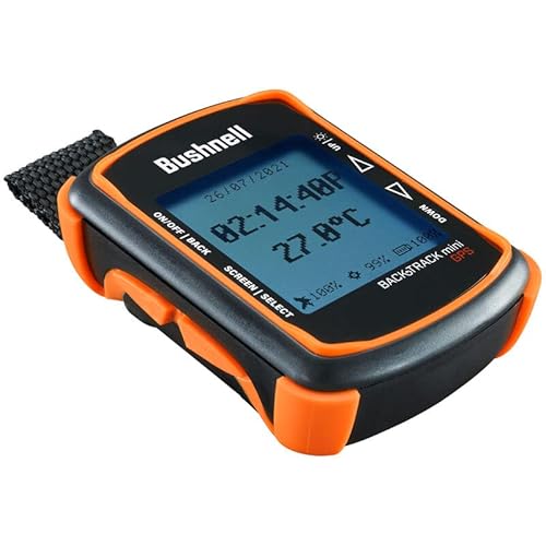
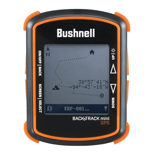


Bushnell BackTrack Mini GPS Navigation, Portable Waterproof GPS for Hiking Hunting and Backpacking
| SELLER | SELLER SCORE | AMAZON FULFILLED | PRIME | FREE SHIPPING |
|---|---|---|---|---|
| I Live Outdoors | 9.67 | No | No | No |
You are miles deep into a dense forest canopy when your smartphone suddenly loses signal and the battery hits zero. This is exactly where the Bushnell BackTrack Mini proves its worth as a dedicated lifeline for backcountry navigation. Unlike a phone, this rugged little device is built to withstand the elements and offers a reliable 35-hour battery life that won't quit on you mid-hike. I found the large, glove-friendly buttons incredibly intuitive for quick adjustments when the weather turns cold. Beyond just finding your way back to the trailhead, it tracks elevation, barometric pressure, and even provides sunrise and moonset times. It is a compact, waterproof essential that syncs your waypoints via Bluetooth, ensuring you never feel truly lost.
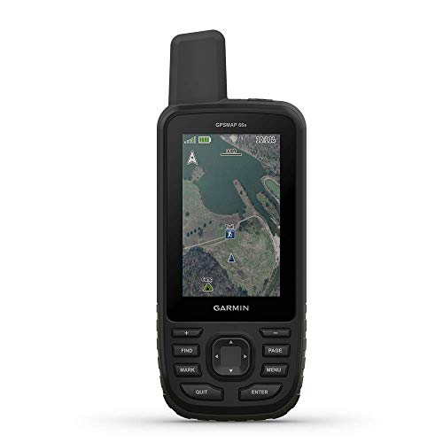


Garmin GPSMAP 66s, Handheld Hiking GPS with 3” Color Display and GPS/GLONASS/Galileo Support (Renewed)
| SELLER | SELLER SCORE | AMAZON FULFILLED | PRIME | FREE SHIPPING |
|---|---|---|---|---|
| Tech-Boutique | 9.91 | Yes | Yes | Yes |
You might wonder if a dedicated handheld device is still necessary in an era of smartphone apps, but the Garmin GPSMAP 66s proves why specialized hardware remains king in the backcountry. While phones struggle with battery life and signal, this unit thrives by utilizing GPS, GLONASS, and Galileo systems to maintain a lock in the toughest terrain. The 3-inch sunlight-readable color display makes navigating preloaded U.S. and Canada topo maps feel intuitive even under direct midday sun. I particularly like the seamless integration of BirdsEye Satellite Imagery, which downloads directly to the device without the headache of an annual subscription. With built-in barometric altimeters and active weather updates, it feels less like a gadget and more like a critical piece of survival gear.


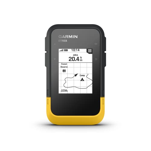
Garmin eTrex® SE GPS Handheld Navigator, Extra Battery Life, Wireless Connectivity, Multi-GNSS Support, Sunlight Readable Screen
| SELLER | SELLER SCORE | AMAZON FULFILLED | PRIME | FREE SHIPPING |
|---|---|---|---|---|
| Amazon.com | 9.68 | Yes | Yes | Yes |
Most modern tech enthusiasts assume that more advanced features always mean shorter battery life, but the Garmin eTrex SE flips that logic on its head. While your smartphone might die halfway through a rugged trek, this handheld unit can run for a staggering 1,800 hours in expedition mode using just two AA batteries. The 2.2-inch high-resolution screen stays perfectly legible even under direct, harsh sunlight, which is a lifesaver when you're off the grid. I found the multi-GNSS support particularly impressive, as it pulls from systems like Galileo and BeiDou to maintain a lock in deep canyons or heavy tree cover. Between the wireless Garmin Explore app integration and the IPX7 water-resistant build, it feels like a rugged, reliable companion for anyone serious about geocaching or backcountry hiking.


GPS Navigator Portable Handheld GPS Compass Location Tracker USB Rechargeable for Outdoor Hiking Traveling Hunting Wild Exploration AC110V US Plug
| SELLER | SELLER SCORE | AMAZON FULFILLED | PRIME | FREE SHIPPING |
|---|---|---|---|---|
| Mirandalong-US | 7.91 | No | No | No |
The Jeanoko handheld GPS navigator is a surprisingly versatile tool that bridges the gap between a simple hiking compass and a professional-grade field instrument. While most travelers just want to find their way home, this device excels by offering specialized utility for much more technical workflows. I found the ability to switch from standard navigation to specific tasks like acreage measurement for agriculture or area calculation for forestry planning to be a massive advantage for field professionals. Whether you are a geologist conducting water quality surveys, a fisherman marking precise coordinates, or a technician managing network base station locations, this rechargeable unit handles diverse data needs with ease. It feels like a rugged, multi-purpose companion for anyone whose work or hobby takes them deep into the wild.
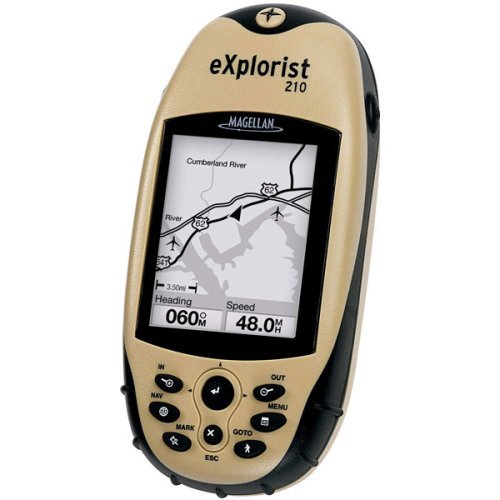
Magellan eXplorist 210 Waterproof Hiking GPS (Discontinued by Manufacturer) (Renewed)
| SELLER | SELLER SCORE | AMAZON FULFILLED | PRIME | FREE SHIPPING |
|---|---|---|---|---|
| ZKarlo Renewed | 8.98 | No | No | No |
Most hikers settle for the imprecise location tracking of a smartphone, but the Magellan eXplorist 210 offers the rugged reliability that true backcountry exploration demands. This compact device is built for the elements, featuring a waterproof, outdoor-sports design that won't quit when the weather turns. I found the 2.3-inch backlit display easy to read even in dim conditions, and the 14-channel WAAS receiver provides the high-accuracy positioning necessary for staying on course. While it is a compact unit at just over six ounces, it packs a punch with a 10 MB built-in basemap covering roads, parks, and waterways. You also get 22 MB of expandable memory for MapSend content and the Magellan Geocache Manager software, making it a specialized tool for serious enthusiasts rather than a casual gadget.


Magellan Triton 1500 Waterproof Hiking GPS (Renewed)
| SELLER | SELLER SCORE | AMAZON FULFILLED | PRIME | FREE SHIPPING |
|---|---|---|---|---|
| ZKarlo Renewed | 8.97 | No | No | No |
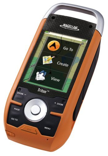
Can a single handheld device truly serve as both a navigator and a survival companion? The Magellan Triton 1500 aims to do exactly that by blending high-tech mapping with essential outdoor utilities. During testing, the 2.7-inch full-color touchscreen felt remarkably intuitive for a device designed to be used in rugged environments. It isn't just about finding your coordinates, though. The inclusion of an embedded LED flashlight and an integrated speaker for audio recordings adds a layer of practical safety that most GPS units lack. You can even pass the time on long treks by listening to MP3s or audiobooks. It is a versatile, waterproof tool that manages to feel like a multi-purpose toolkit rather than just a simple compass.



Garmin Forerunner 265 Running Smartwatch, Colorful AMOLED Display, Training Metrics and Recovery Insights, Whitestone and Tidal Blue
| SELLER | SELLER SCORE | AMAZON FULFILLED | PRIME | FREE SHIPPING |
|---|---|---|---|---|
| Trend Genie | 9.83 | No | No | No |
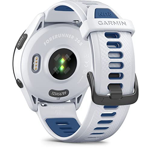
Can a single wearable actually bridge the gap between raw data and actionable coaching? The Garmin Forerunner 265 makes a compelling case for doing exactly that through its vibrant AMOLED touchscreen and deep physiological insights. I found the morning report particularly transformative, offering a concise snapshot of sleep, recovery, and training outlook before I even lace up my shoes. It doesn't just track your miles. It uses metrics like HRV status and training readiness to tell you if you are actually prepared to push your limits or if you need a rest day. With multi-band GNSS for precise tracking in tricky terrain and a battery that lasts up to 13 days, this is a sophisticated tool for anyone serious about optimizing their athletic performance.


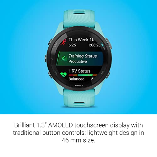

Garmin Forerunner 265 Running Smartwatch, Colorful AMOLED Display, Training Metrics and Recovery Insights, Aqua and Black
| SELLER | SELLER SCORE | AMAZON FULFILLED | PRIME | FREE SHIPPING |
|---|---|---|---|---|
| Trend Genie | 9.83 | No | No | No |
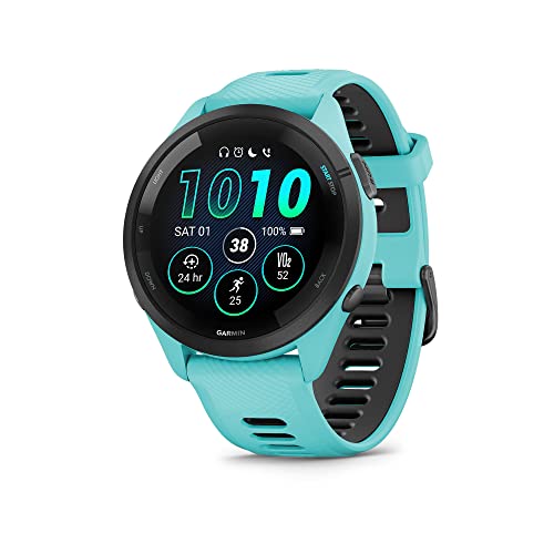
Athletes often struggle to decipher whether their training is actually driving progress or simply leading to burnout. The Garmin Forerunner 265 solves this by turning complex physiological data into actionable intelligence right on its vibrant AMOLED touchscreen. I found the morning report particularly useful. It greets you with a breakdown of sleep, recovery, and training readiness so you know exactly how hard to push before you even lace up. With multi-band GNSS and SatIQ technology, your tracking stays pinpoint accurate in dense environments without killing the battery. Whether you are prepping for a marathon with personalized race strategies or swimming open water, this lightweight 46 mm watch acts as a dedicated coach on your wrist, balancing high-level metrics with essential safety features like incident detection.


Garmin Forerunner® 955, GPS Running Smartwatch, Tailored to Triathletes, Long-Lasting Battery, Whitestone
| SELLER | SELLER SCORE | AMAZON FULFILLED | PRIME | FREE SHIPPING |
|---|---|---|---|---|
| onestopshopandco | 5.47 | Yes | Yes | Yes |
Most high-end fitness trackers demand a daily charging ritual, but the Garmin Forerunner 955 actually thrives on neglect. You can go up to 15 days in smartwatch mode, which is a massive relief when you are deep into a training block or a multi-day adventure. The Whitestone finish looks sharp, and the always-on color display remains legible even under punishing direct sunlight. I found the hybrid interface—using both responsive touch and traditional buttons—to be a lifesaver when my hands were sweaty during a run. Between the built-in full-color mapping and the highly specific training readiness scores, this device moves beyond simple tracking and acts more like a digital coach that tells you exactly when to push your limits and when to prioritize recovery.


Garmin 010-02064-00 Instinct, Rugged Outdoor Watch with GPS, Features Glonass and Galileo, Heart Rate Monitoring and 3-Axis Compass, Graphite
| SELLER | SELLER SCORE | AMAZON FULFILLED | PRIME | FREE SHIPPING |
|---|---|---|---|---|
| Amazon.com | 9.68 | Yes | Yes | Yes |
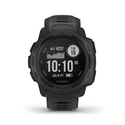
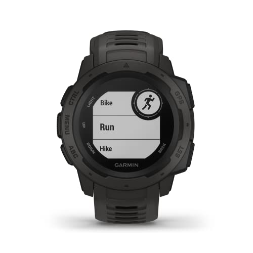
You are halfway up a granite ridge in a sudden downpour, and the last thing you need is a device that freezes or fails. The Garmin Instinct is built specifically for these punishing moments, boasting U.S. Military standard 810G durability for thermal, shock, and water resistance up to 100 meters. I found the navigation incredibly reliable because it doesn't just rely on GPS. It pulls from Glonass and Galileo to keep you on track in dense terrain. The trackback feature is a lifesaver for finding your way back to camp, and the battery life is impressive, lasting up to 14 days in smartwatch mode. Between the heart rate monitoring and the built-in 3-axis compass, it feels like a complete survival tool strapped to your wrist.


Garmin inReach Mini 2, Lightweight and Compact Satellite Communicator, Hiking Handheld, Orange
| SELLER | SELLER SCORE | AMAZON FULFILLED | PRIME | FREE SHIPPING |
|---|---|---|---|---|
| Global Telesat Comms | 5.89 | Yes | Yes | Yes |
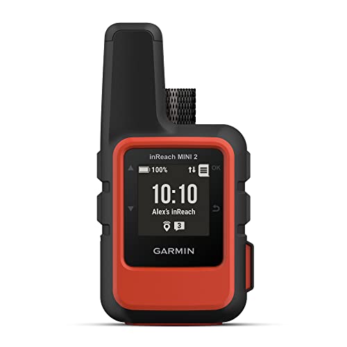
The Garmin inReach Mini 2 redefines backcountry safety by packing global two-way messaging and interactive SOS capabilities into an incredibly lightweight, pocket-sized frame. I found the TracBack routing feature particularly indispensable for navigating back to a starting point when visibility drops or trails vanish. Because it features a digital compass, you get reliable heading information even while standing perfectly still. The integration with the Garmin Explore app makes trip planning and topographical mapping feel seamless on your smartphone. With a battery that lasts up to 14 days in 10-minute tracking mode, this device offers the long-term reliability essential for multi-day treks. It is a rugged, water-resistant lifeline that ensures your coordinates and location are always shared with loved ones via MapShare.
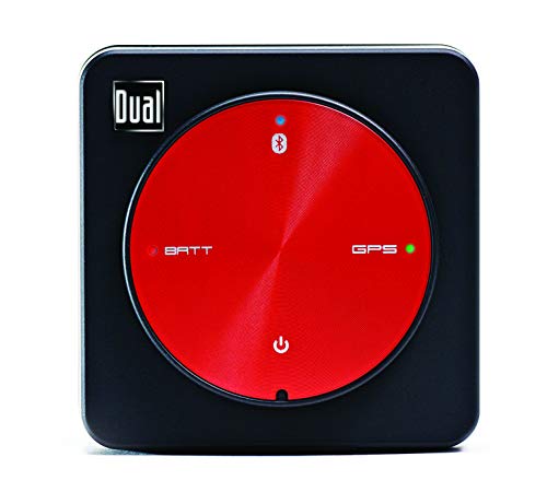


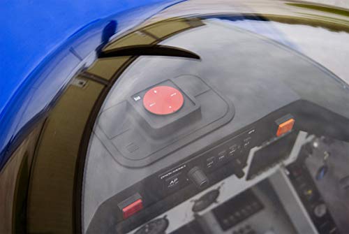

Dual Electronics XGPS150A Multipurpose Portable Universal Bluetooth GPS Receiver | Wide Area Augmentation System
| SELLER | SELLER SCORE | AMAZON FULFILLED | PRIME | FREE SHIPPING |
|---|---|---|---|---|
| Amazon.com | 9.68 | Yes | Yes | Yes |
Outdoor enthusiasts and mobile professionals who struggle with weak device positioning need the Dual Electronics XGPS150A to unlock true navigational precision. This compact receiver solves the headache of inaccurate smartphone signals by providing a high-strength Wide Area Augmentation System connection via Bluetooth in just seconds. I found the versatility impressive. Whether you are navigating a boat, hiking a remote trail, or flying, it integrates seamlessly with iPhone, Android, Mac, and Windows through a dedicated status app. The unit is rugged enough for the elements thanks to its water-resistant build, and it comes fully loaded with a car charger, an adjustable strap, and a non-slip pad for secure mounting. With 8.5 hours of continuous battery life, it is a reliable companion for any long-distance excursion.


Bands Compatible with Bushnell Neo Ion 1& 2 Soft Silicone Replacement Two-Color Breathable Hole Wristband Compatible with Bushnell Neo Ion 1&2 & Bushn...
| SELLER | SELLER SCORE | AMAZON FULFILLED | PRIME | FREE SHIPPING |
|---|---|---|---|---|
| FitTurn | 9.80 | Yes | Yes | Yes |
Standard golf GPS bands often become sweaty and uncomfortable during a long round on the course, which is exactly why this Turnwin replacement strap is such a game-changer. The soft silicone material feels incredibly smooth against the skin, but the real standout feature is the integrated air-hole design. These holes provide much-needed breathability, preventing that typical skin irritation or rash when you're hiking or out in the sun. Installation is straightforward since you just secure the screw into the original metal stick, and the stainless steel buckle offers a secure, reliable lock. Whether you are swinging a club or out camping, the sporty two-color design adds a bit of energy to your gear while ensuring your device stays firmly on your wrist.

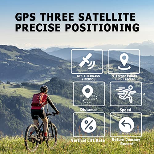
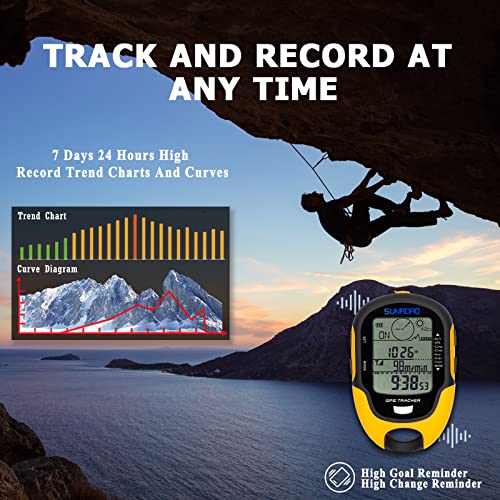


SUNROAD GPS Digital Waterproof Outdoor Altitude Pre-Warning Remind Compass Stopwatch Sports Altimeter-Barometer Weather Forcast Pedometer (Yellow)
| SELLER | SELLER SCORE | AMAZON FULFILLED | PRIME | FREE SHIPPING |
|---|---|---|---|---|
| SUNROAD INC. | 9.37 | Yes | Yes | Yes |
The SUNROAD GPS Digital Watch delivers professional-grade satellite tracking in a rugged, high-visibility yellow chassis. What really sets this device apart is the triple-system compatibility, utilizing GPS, GLONASS, and BeiDou to maintain an incredible 1-meter positioning accuracy even in remote areas. I was particularly impressed by the altimeter's ability to log historical trends over 24 hours and seven days, complete with customizable height alerts. It functions as a true survival tool, combining a Swiss-sensor 16-position compass with a barometer and weather forecasting capabilities. Whether you are tracking nine different route groups or using the built-in LED flashlight during an emergency, the interface remains intuitive. It is a comprehensive, rechargeable toolkit for hikers who need reliable data without the premium price tag.


Garmin epix
| SELLER | SELLER SCORE | AMAZON FULFILLED | PRIME | FREE SHIPPING |
|---|---|---|---|---|
| SpddyS LLC | 6.86 | No | No | No |
The Garmin epix redefines outdoor navigation through its stunning 1.4-inch high-resolution Chroma touchscreen that remains perfectly visible even under direct sunlight. I found the interface incredibly intuitive, especially when switching between specialized modes like mountaineering, swimming, or hiking. With 8 GB of internal memory, you can load comprehensive TOPO U.S. 24K and City Navigator NT maps directly onto your wrist, which is a game-changer for remote treks. It isn't just a fitness tracker. The Connect IQ app allows for deep customization of widgets and faces, while smart notifications keep you tethered to texts and emails without breaking your stride. It seamlessly syncs everything to Garmin Connect, making it a powerhouse for anyone serious about tracking multi-activity performance.

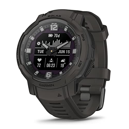



Garmin Instinct Crossover Solar (Graphite) Hybrid Rugged Smart Watch with Analog Hands & Digital Display | Gift Box Bundle with Screen Protectors, Car...
| SELLER | SELLER SCORE | AMAZON FULFILLED | PRIME | FREE SHIPPING |
|---|---|---|---|---|
| The PlayBetter Store | 9.80 | No | No | No |
The Garmin Instinct Crossover Solar redefines the rugged smartwatch by blending traditional analog hands with a high-tech digital display. I was immediately struck by the RevoDrive technology, which ensures your timekeeping remains pinpoint accurate even when you are pushing through extreme environments. This isn't just a pretty timepiece. It is built to MIL-STD-810 standards for shock and thermal resistance, making it a true beast for mountain biking or heavy strength training. You get deep health insights like sleep scores and heart rate monitoring, plus the convenience of Garmin Pay for quick transactions. This specific PlayBetter bundle adds massive value by including screen protectors, a hard case, and charging adapters, making it a complete, ready-to-go kit for any serious adventurer.


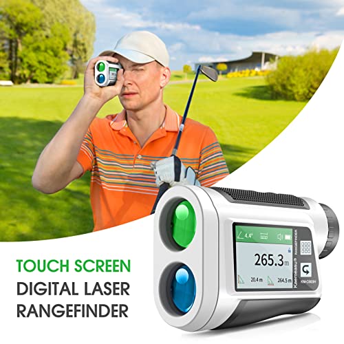
dsfen Golf rangefinder with LCD Touch Screen 6X Magnification 600M / 800M USB Rechargeable Range Finder Distance Meter with Speaker Slope Function Fla...
| SELLER | SELLER SCORE | AMAZON FULFILLED | PRIME | FREE SHIPPING |
|---|---|---|---|---|
| QinHuanjue | 4.05 | No | No | No |
Serious golfers who demand data-driven precision without the bulk of traditional handheld units will find the dsfen rangefinder to be a total game-changer. I was immediately struck by the vibrant LCD color touch screen, which makes navigating complex modes like area, volume, and two-point height measurements feel intuitive rather than a chore. The 6X magnification through the multi-coated lens delivers incredibly sharp resolution, while the haptic vibration feedback ensures you never miss a flag lock or slope adjustment. Whether you are calculating vertical angles or relying on the intelligent speaker to read distances aloud, this device handles everything with +/- 0.5m accuracy. It is compact enough to slip into a pocket, making it a versatile tool that extends far beyond the fairway into hiking or forestry work.


RiToEasysports Multifunctional Digital Altimeter Barometer,Handheld USB Rechargeable GPS Navigation Receiver for Outdoor Climbing, Hiking, Hunting, Ca...
| SELLER | SELLER SCORE | AMAZON FULFILLED | PRIME | FREE SHIPPING |
|---|---|---|---|---|
| Tenyse-K | 9.66 | Yes | Yes | Yes |
You might wonder if a budget-friendly handheld device can actually replace dedicated high-end navigation gear, but the RiToEasysports multifunctional altimeter proves surprisingly capable for the price. While testing it for hiking and climbing, the dual GPS and Beidou navigation systems provided the reliable location accuracy needed when trails get murky. It is a true Swiss Army knife for your pack, displaying everything from climbing speed and atmospheric pressure to humidity and temperature. I particularly appreciated the integrated mini torch for quick visibility during dusk transitions, and the USB rechargeable battery holds up well even in harsh weather ranging from -20℃ to 60℃. It turns a simple compass into a comprehensive survival toolkit.

The most critical distinction in the modern market is whether your device is a simple navigator or a two-way communication tool. Standard GPS units receive signals from satellites to tell you where you are, but they cannot send signals back. However, many premium handhelds now integrate satellite messaging technology. This allows you to send text messages to emergency contacts or trigger an SOS signal via a global satellite network when you are far beyond the reach of cellular towers. If you frequently trek solo or enter areas with zero cell service, prioritizing a device with integrated satellite messaging is a non-negotiable safety upgrade.
A GPS unit is useless if you cannot read the screen while standing in direct sunlight or during a heavy downpour. You will generally encounter two types of displays: reflective memory-in-pixel (MIP) screens and color liquid crystal displays (LCD). MIP screens are the gold standard for outdoor enthusiasts because they actually become clearer the brighter the sunlight gets, and they consume incredibly low power. While they may lack the vibrant colors of a smartphone, their sunlight readability and battery efficiency make them superior for long-distance hiking. If you prioritize high-detail topographic maps with color-coded elevation lines, you may prefer a higher-resolution color screen, but be prepared for significantly shorter battery life.
When you are miles from the trailhead, battery life is your lifeline. Look for units that offer extensive battery longevity in 'tracking mode.' Some devices can run for dozens, or even hundreds, of hours on a single charge. Pay close attention to how the device is powered. Some use internal rechargeable lithium-ion batteries, which are convenient but can be difficult to replenish in the wild. Others utilize replaceable AA or AAA alkaline/lithium batteries, which allow you to carry spares as a failsafe. For multi-day expeditions, a device that accepts standard replaceable batteries is often the more reliable choice.
The quality of the onboard cartography determines how easily you can interpret your surroundings. Look for units that support high-resolution topographic maps, including contour lines, water features, and trail markings. A great handheld unit should allow you to zoom in and out fluidly without the interface lagging. Furthermore, consider the physical interface. While touchscreens are intuitive, they often fail when your hands are wet, cold, or covered in gloves. Many seasoned hikers prefer devices with tactile, physical buttons that provide haptic feedback, ensuring you can navigate accurately even in the middle of a thunderstorm.
A hiking GPS is a tool, not a toy. It must be able to withstand drops on granite, immersion in streams, and extreme thermal shifts. Look for devices with high Ingress Protection (IP) ratings and MIL-STD certifications for shock and thermal resistance. A ruggedized chassis is essential to ensure that a simple slip of the hand doesn't result in a total loss of navigation capability mid-trip.
Quick answers about Hiking Handheld Gps Units before you buy.
Share of top-ranked products by brand, from our editorial analysis.
We've carried out a comprehensive analysis of 42,620 reviews on Hiking Handheld Gps Units, using our selection criteria to identify the best options in the categories. Our findings reveal that most customers typically select Hiking Handheld Gps Units priced around $301.40, with top brands including garmin, magellan, wearable4u, jeanoko and spot x and bushnell.
Our team of expert editors reviewed these high-quality items and handpicked the top 27 Hiking Handheld Gps Units for your consideration. We've also done extensive research on numerous sellers, identifying the best ones in the categories category — including trend genie, onestopshopandco, amazon.com, zkarlo renewed, top sports, tech-boutique, sports-and-gadgets, mirandalong-us and spot llc. and gps city.
We are dedicated to assisting our users in finding the right units Products based on their needs, saving them considerable time when choosing which Hiking Handheld Gps Units to buy. We take pride in the number of satisfied users we've helped through our thorough and insightful reviews.
Compare the top 27 picks at a glance — select a column to sort.


